Club meetings
Club meetings take place at the Round Table Pizza.
Club meetings take place at the Round Table Pizza.
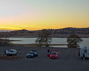
Eastman Lake is a reservoir managed by the United States Arms Corps of Engineers, located in the foothills in Madera County. We use the parking lot next to the Cordoniz Boat Ramp as our observing site.
From Fresno, take Highway 99 to the Cleveland Avenue exit in Madera, and turn right. At the intersection, follow the road as it makes a slight left and turns into Country Club Drive (and then Road 26). Go approximately 10 miles and turn right onto Avenue 26. After three miles it dead-ends; turn left onto Road 29. Follow Road 29 until it dead-ends in a large parking lot with a restroom structure.
From the Yosemite Lakes or Oakhurst area, use Road 400 or Road 600 to make your way to Road 603. Follow Road 603 until it dead-ends, and make a right turn onto Road 29. Follow Road 29 until it dead-ends in a large parking lot with a restroom structure.
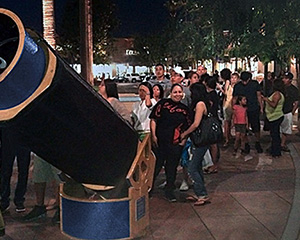
River Park is an outdoor shopping center in Fresno. Sidewalk astronomy events take place in a section of Via la Plata Avenue that is closed off specifically for our star parties. It is located on the East side of Blackstone Avenue between Nees and Alluvial.
If turning East on the Via la Plata entrance to River Park, turn left and park in the Parking Lot just West of Panera Bread and REI. Walk East between the two buildings and you will be at our observing location, straight West from the entrance from Edwards Theatre.
If turning East on El Paso Avenue, park in one of the parking lots on the North side of the street. Walk North between the buildings and you will be at our observing location, straight West from the entrance from Edwards Theatre.
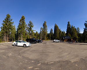
The Big Stump Recreation Area parking lot is a location that some of our members use as an alternate observing spot due to its close distance from Fresno and the dark skies afforded to it by its elevation.
Take Highway 180 East until you reach the Kings Canyon National Park gate. Once inside, continue on Highway 180 for another 1/2 mile and turn into the parking lot on the left. This parking lot is our observing site.
Remarks: This parking lot is used as an alternate observing site only. You should not expect club members to be present unless specifically informed. Entry into Kings Canyon National Park is not free. A per-vehicle daily use fee applies, or you may purchase an annual pass.
The McKenzie Heliport parking lot is a location that some of our members use as an alternate observing spot when they want t go to Big Stump as it is closer to Fresno and it is warmer during the Winter months.
Take Highway 180 East until Cyndi's Snowline Lodge, then turn left at the next intersection. 100 yards after on the left, you can find the parking lot that is our observing site.
Remarks: This location is used as an alternate observing site only. You should not expect club members to be present unless specifically informed.
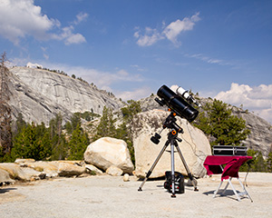
Our observing and camping location at Courtright Reservoir is a large, flat granite area on the East side of the reservoir, just before the Dusy-Ersham four-wheel-drive trailhead.
Take Highway 168 East up into Shaver Lake town. After entering the town, turn right on Dinkey Creek Road and go approximately 13 miles. Just before the Dinkey Creek Campsite, turn right on McKinley Grove Road. Drive until you reach a long straightaway and a fork; turn left onto Courtright Road.
Once you arrive at Courtright Reservoir, follow the road to the right, past the pump house and over the Courtright Dam. Continue down the road until you see a set of green metal gate posts. Go through the posts and immediately turn right onto the granite slab. This is our observing spot.